IRES – Prague Week 3 [Zablon, Catherine, Jessica, and Alisha]
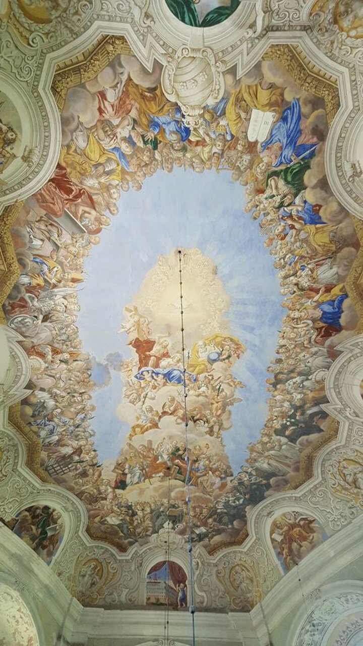
Following introduction lectures to fundamentals of soil physics (Week 1) and equipment calibration and preparation for fieldwork (Week 2), Week 3 mainly focused on installations of hydrogeological monitoring sensors, infiltration tests, and geophysical measurements of structurally imperiled 17th Century churches of St. Anne in Vižňov and All Saints in Heřmánkovice, which are part of a group of eight churches in the Broumov area inducted into the Czech Cultural Heritage. One of the overall objectives of this project is help achieve UNESCO world heritage site designation by improving the structural integrity of the churches.
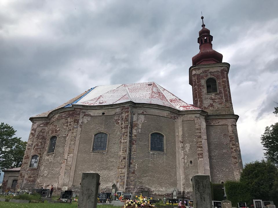
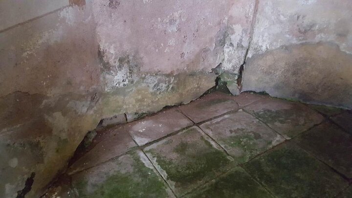
These churches are experiencing significant damage to the outer structure extending from exposed foundation, flaking and cracking walls, and deteriorating roof materials. More importantly, there is extensive physical water damage to the interior walls, floors, and foundations. The severity of the damage has put these historically important churches, along with six others in the Broumov area alone, at a risk of collapse in the future.
The overall objective of this multidisciplinary research expedition is to install hydrogeological monitoring equipment and perform geophysical measurements to identify the conditions and processes in which water is penetrating the walls and foundations of these churches. Although the water damage is visible to the naked eye, the processes in which water is entering the churches are less apparent and can include high groundwater elevation beneath the foundation, lack of extensive gutter system and improper drain installations, sloped lateral water flow from the higher elevation side of the perimeter or can even be a permutation of any of these conditions.
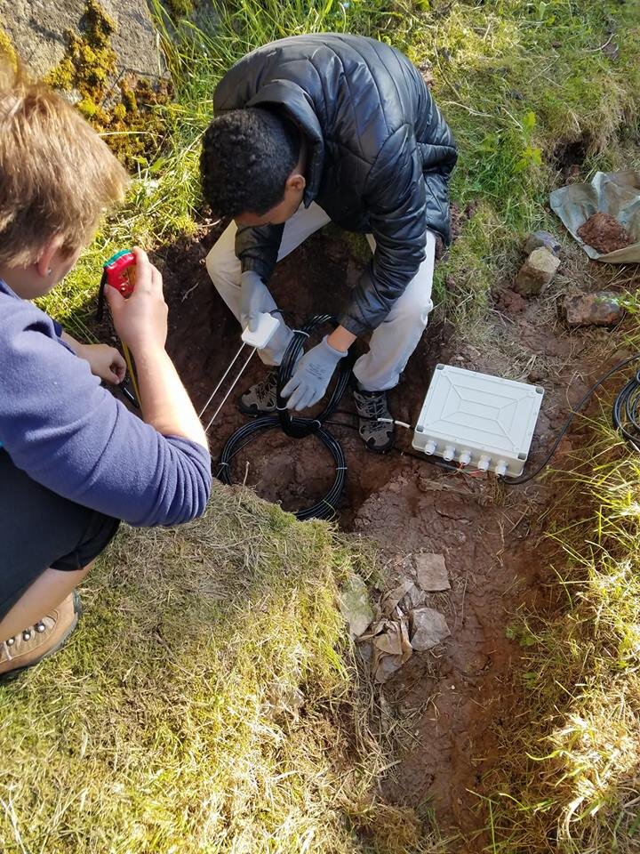
At the St. Anne Church, Time Domain Reflectometry (TDR) moisture sensors were installed in the interior wall of the church closest to the evident water damage. In principle, this TDR sensor will send a pulse through the medium and signal propagation and reflection will vary depending on the moisture content of the medium (soil or wall). The TDR measurements will help reveal if water is proliferating down or through the wall and contributing to the water damage at the bottom of the wall, the floor, and eventually the foundation. Campbell Scientific TDR soil moisture sensors were also installed in the ground at 25 cm and 50 cm depths at two different locations outside of the church in the direction of the water damage: the first, just on the other side of the church wall (~1 meter away) and the second, ~8 meters away.
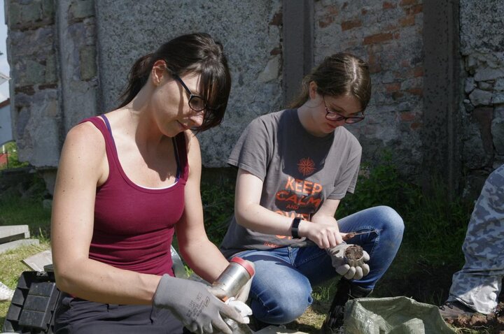
Several disturbed and undisturbed soil samples were also collected on both of the excavations prepared for the installations of the TDR sensors (~1 m and 8 m away) and at 10 cm, 20 cm, and 30 depths. The samples will be used to characterize the soil composition and obtain soil hydraulic properties through pressure chamber in the laboratory and the results can be used to understand the results of the sensors, infiltration tests, and in the numerical modeling of the soil profile later in the program.
Decagon mini-disk infiltrometer was also set up to measure infiltration rates of the sandstone that is typical of the material used to construct the church. The measurement will provide an insight into the conductivity of the sandstone along the walls and the foundation of the church. The mini-disk infiltrometer was placed on a block of sandstone containing 70 ml of water at –3 cm of pressure. Infiltration times were recorded for every 2 ml of water infiltrated and cumulative infiltration of approximately 26 ml of water recorded over the 4 hour monitoring.
The IRES group also successfully deployed CTU’s calibrated automated inflitrometer prototype for the first time in the field. This prototype contains 6 infiltrometers approximately 32 cm apart designed to account for spatial heterogeneity and variability of soils within a small designated soil plot. An area of approximately 1 m x 0.6 m was excavated to a depth of 18 cm; just beneath the lawn grass roots. Six small areas corresponding to each of the infiltrometer columns were carefully prepared to create good contact between the soil and infiltrometer plates through smoothing and leveling. The infiltrations were conducted at –6 cm pressure at St. Anne’s and at –6 cm and – 3 cm pressure at All Saints Church in Broumov.
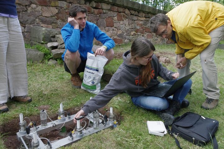
While the prototype is excellent in its automation and the arrangement of infitrometers to account of variability, the preparation to create proper contact with the soil was time intensive on less ideal soils (i.e. rocky). The IRES group made suggestions to improve the prototype such as triangular (3 infiltrometers) rather than rectangular (6 infiltrometers) arrangements to reduce preparation time. The triangle idea has also been considered by CTU and is in the works for the next prototype. The group also suggested flexible rather than stationary infiltrometer setup so that each infilterometer can be deployed independently at more convenient locations, which can help to avoid rocks or roots embedded in soils during infiltration tests. The cumulative infiltrometer results obtained from the prototype infiltrometer appear to be reasonable and promising but will likely need further scrutiny. Once the data from each infiltrometer is matched to its calibration, the Philips infiltration equation and square root of time will be used to calculate the unsaturated hydraulic conductivity values. These results will be included in reports in the coming weeks.
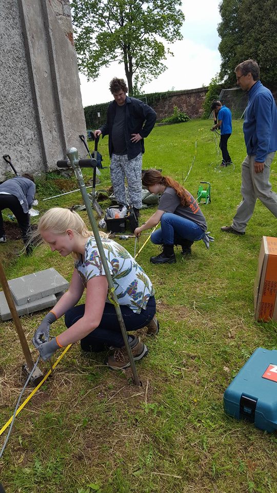
Geophysical surveys were also performed along 2 long (~80 meter) transects on the side of the church experiencing the water damage (higher elevation) as well as the opposite side (lower elevation). This geophysical survey measures variations in the electrical resistivity of the ground and will be processed to produce graphic depth images to provide information regarding existing subterranean conditions, which can be used to infer water flow through the subsurface. The results for this survey will be included in a future weekly report.
Overall, through these diverse types of measurements and active monitoring, the project expects to answer the mechanism in which water is contributing to the deterioration of these churches and make recommendation on how to limit water intrusion into the church walls and foundations to hopefully prolong the lifetime of these impressive and historically significant churches. Next week (Week 4) is designated for a 4 day fieldwork expedition in the Jizera Mountains; therefore, the results for all these measurements will likely be covered starting Week 5.